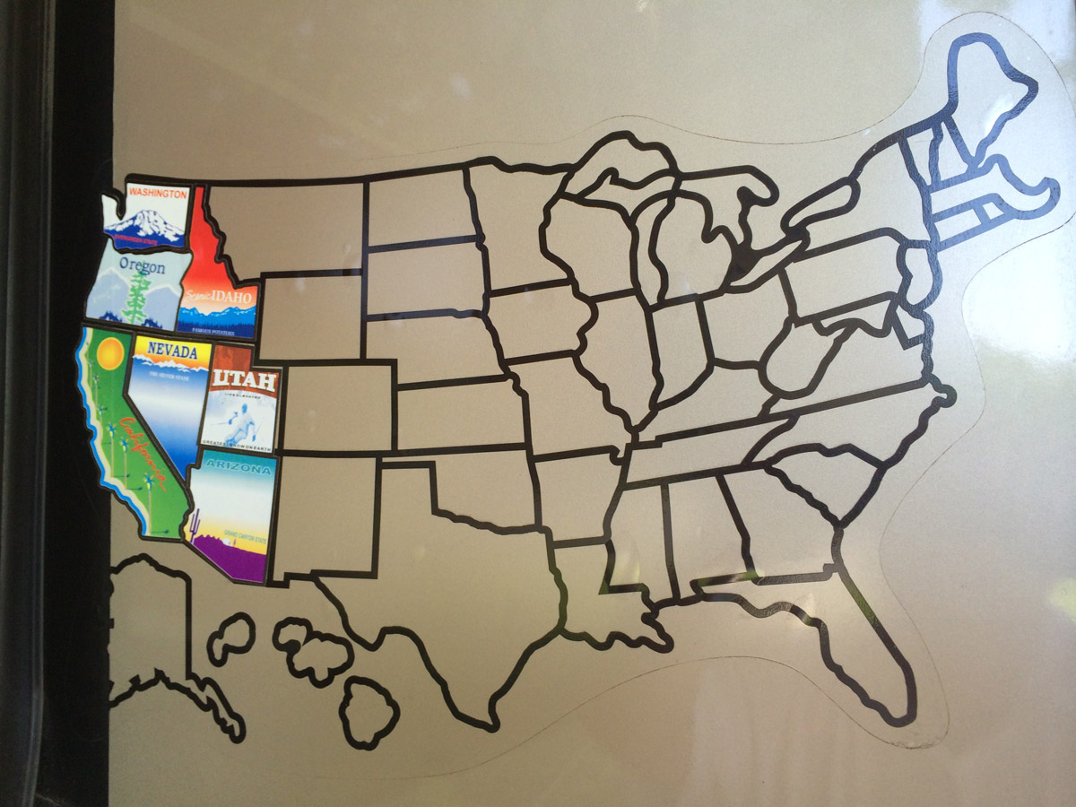
Our US travel map sticker…it’s posted outside on the slide-out by the patio awning area. “We’re getting there.”
JUNE 4, 2014
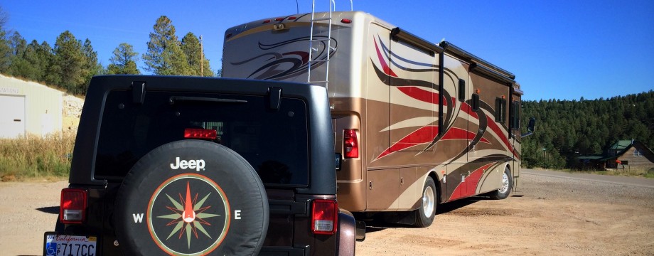
We’ve been traveling and living in our motor-home on a full time basis for almost a year and we’re “getting there” on our Journey across America. I’ve driven about 6,000 miles. We’ve learned lots about our rig and lots about ourselves as we’ve grown accustomed to true retirement and its guiding principle: “What’s the rush?” It’s good we’ve come to grips with the reality that we’ve got all the time in the world and that we needn’t hurry, since we’ve found that our Journey is unfolding slowly and that it’s going to take much longer than we suspected to see the country and all that it holds for us. What we don’t want to do is mimic the “city bus tour” approach to travel, which allows for not much more than briefly laying eyes on the places we visit. We’re trying to balance our desire to get a close look at American while keeping in mind that there’s a lot of ground to cover and there remain many, many places we still want to explore.
Today we’re in Kelso, Washington. We’re spending a few days in the sunshine getting ready to head north to the Olympic Peninsula, which promises to be one of the highlights of our trip. We’d initially planned to head east by now, en route to our destination in Maine to begin our trek down the eastern seaboard in search of fresh lobster and the Fall foliage colors. So many travelers we’ve met along the way in the last month or so have almost insisted that we go to the Peninsula, however, that we decided we’d be foolish not to to follow their advice. The more we’ve researched it, the more we agree with that advice.
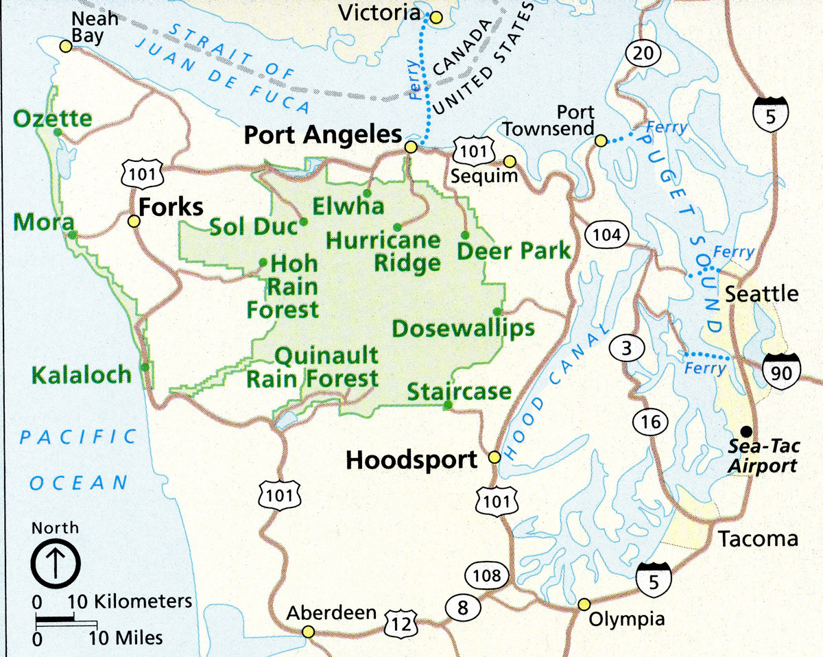
Our route will take us from Olympia through Hoodsport, Staircase, Sequim, Port Angeles, Forks and the Hoh Rain Forest. You’re going to love my photos of Olympic National Park!
THE OLYMPIC PENINSULA: The peninsula is perhaps the most gorgeous part of the entire state of Washington. It’s a large arm of land at the western side of the state, and lies across Puget sound from Seattle. It’s bounded on the west by the Pacific Ocean, on the north by the Strait of Juan de Fuca and on the east by the Hood Canal. Cape Alava is the western-most point in the contiguous United States. Cape Flattery is the northwestern-most point…just a stone’s throw to Vancouver Island in British Columbia. The peninsula contains many of the last places in America to be explored. It was largely unmapped until about 1900.
The peninsula is home to temperate rain forests, including the Hoh, Queets and Quinault. Rain forest vegetation is concentrated primarily in the western part of the area. The landscape varies from the temperate Olympic forest to the salt water fjord of Hood Canal to the peaks of Mt. Washington. Annual precipitation averages well above 100 inches. That’s a lot of rain for a boy from Southern California!
The Olympic mountain range sits in the center of the peninsula. This range is the second-largest in Washington State…its highest peak is Mt. Olympus. There are many major salmon-bearing rivers here and also lots of natural lakes. There are many state and national parks, as well as five designated wilderness areas. We’re going to see as much as we can…the Olympic Peninsula is our next destination.