browser icon
You are using an insecure version of your web browser. Please update your browser!
Using an outdated browser makes your computer unsafe. For a safer, faster, more enjoyable user experience, please update your browser today or try a newer browser.
Our Great American Adventure Website Logo

Camping at the Elks Lodge in Forks, Washington…

DSCN2563

Our RV spot at the Elks Club in Forks is very nice…and very private, too. We’re the only ones here! No hook-ups, no neighbors, no noise, no pavement…no worries. Perfect!

JUNE 21 – JUNE 24, 2014. Home base for us while we’re in Forks is at the local Elks Lodge. That’s right…the Elks Lodge. Here’s the story: About a year ago just prior to beginning our Journey, I was having lunch with a friend and discussing how excited I was about our upcoming adventure. He asked me, “Have you joined the Elks Club?” Mr response was: “Here I am telling you about the biggest adventure of my entire life and you ask  me about the Elks Club…what’s that all about?”  He explained that there are Elks lodges all across the United States, and most have RV parks or at least RV parking for members. “Sounds good to me” I thought and within a few weeks I’d joined and become an Elk. I thought it would be silly…secret handshakes and such, but it turns out that there’s a lot to the organization in addition to free RV parking. Here’s the deal:

Read more »

Categories: Olympic Peninsula, Washington | Comments Off on Camping at the Elks Lodge in Forks, Washington…

Forks, Washington…

forks

Forks is at “the end of the line.” You can’t go hardly any farther north in the continental United States.

JUNE 21, 2014

EVER HEARD OF FORKS? Forks, Washington that is. A little town on the Olympic Peninsula so far north in the continental United States there’s almost nowhere else to go! Unless you’re a surfer or a hiker, there’s only one reason most folks travel to this remote spot. Read on…


forks

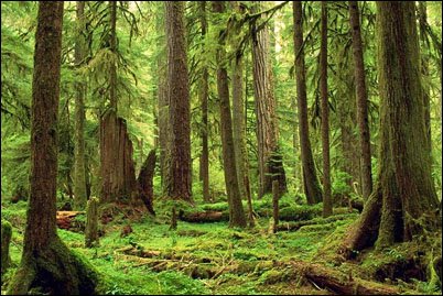
The rainforest near Forks. It’s the perfect setting for the Twighlight books and movie series. Forks is the new ground zero for anything vampire!

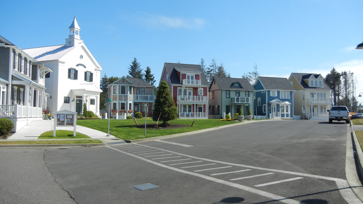
FORKS, WASHINGTON. We’ve come to Forks to continue our exploration of the Olympic Peninsula. But aside from that, there are very few reasons to travel 3 1/2 hours northwest from Seattle to the remote cit of Forks unless you are a surfer, hiker or Twighlight motion picture series follower. “It isn’t the end of the world, but you can see it from there.” So goes a popular Northwest saying about this vicinity.

Once the center of the Northwest logging industry during the 1080’s and early 90’s, Forks is making a comeback in a way most could never have foreseen…as the hometown of fictional teenager Bella Swan, the main character in the vampire-esque book series, and now hit movie, Twighlight. Florence loves the books and movies, so being here is especially fun for her.

Forks has a population of about 3,000 and is the rainiest city in the 48 contiguous states with well over 120 inches of rain a year. Chances are it is dark and gloomy, which is a main reason why Twighlight’s author, Stephenie Meyer…who never visited Forks…chose it for its fascinatingly lush, mossy setting. Most residents live and work in and around the area because the next closest city, Port Angeles, is a long and windy hour drive away. To be honest, Forks is in the middle of nowhere, the resources are limited, it has very few days of sunshine per year and the closest real shopping area is more than three hours away! The beautiful, unusual scenery and rain forest areas, however, are what we came to see, and we’ve not been disappointed.

map

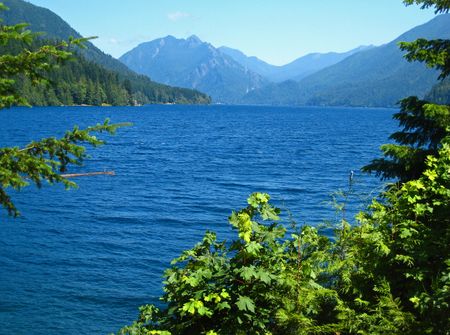
In Olympic National Park, you can see towering mountains, unspoiled beaches and the lush and amazing rainforest…all in the space of one day!

The city of Forks has reported an increase in tourists and avid fans who are trying to get a closer look at the town the Swans and Cullens call home. Ironically, most of Twilight was filmed in Oregon and some other parts of Washington, but not Forks. This is because Oregon offered tax concessions and because the movie producers feared that little Forks could not accommodate all of the movie folks’ housing and culinary needs. That’s OK…Forks is now the de facto Twilight shrine, with fans arriving from every corner of the U.S. All hail Forks, the new ground zero for anything vampire!

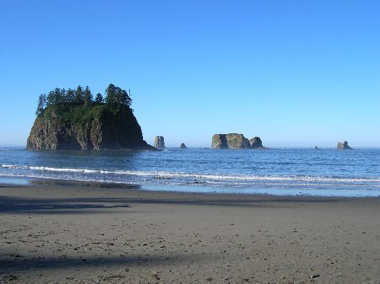
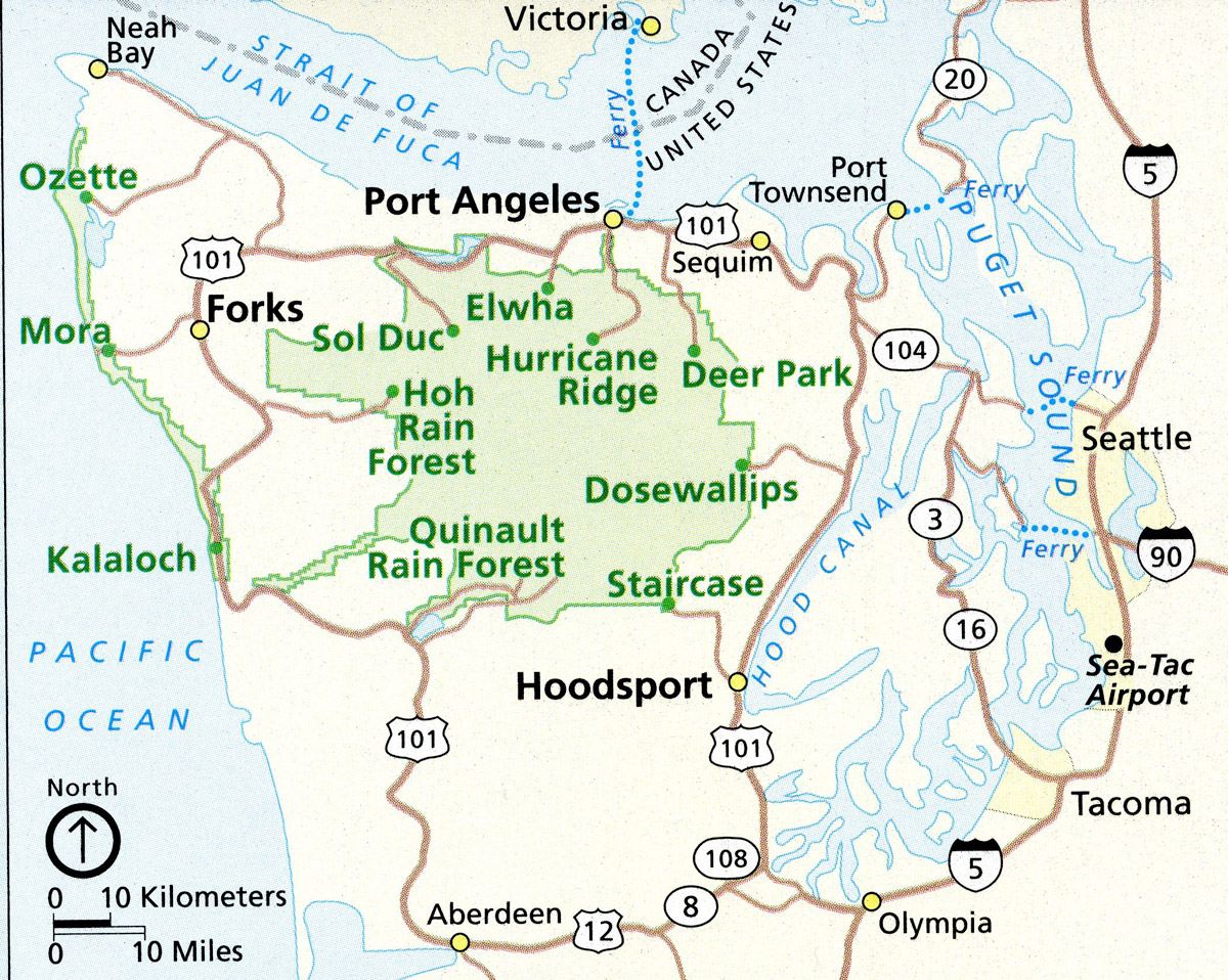
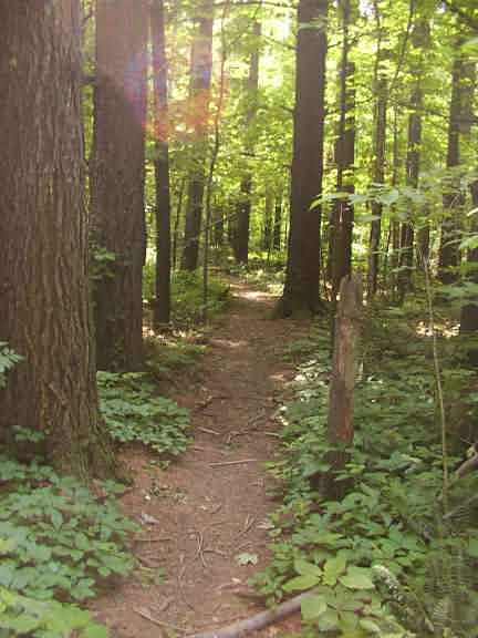
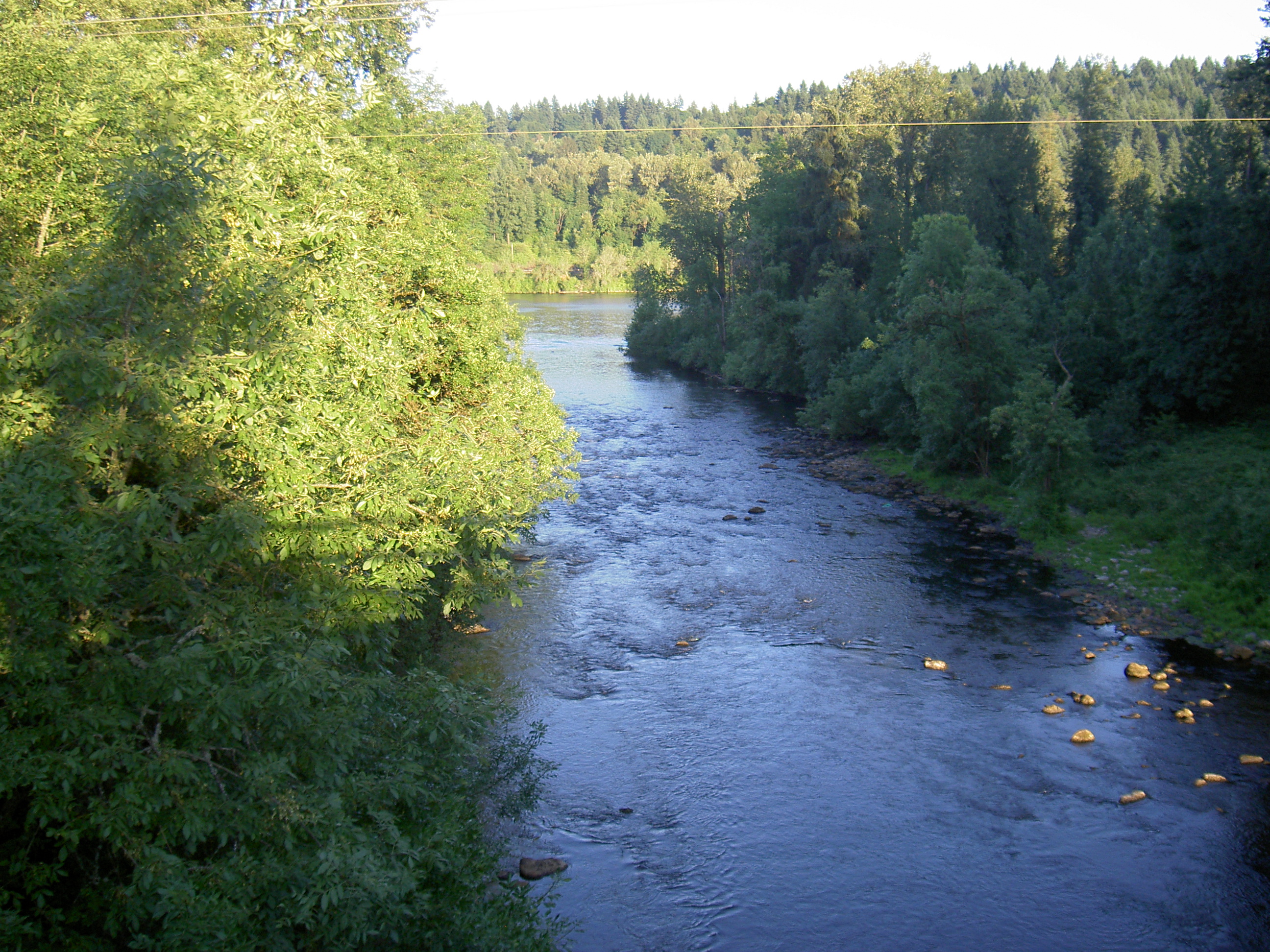
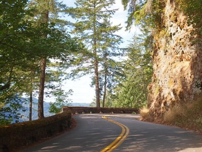
OLYMPIC NATIONAL PARK…A PRIMER. This is probably a good post-spot to include some general information about the Olympic National Park. Lots of the areas we’ll be visiting in the next few days fall within the park, so here’s an overview: the park has four basic regions…the Pacific coastline, alpine areas, the west side temperate rainforest and the forests of the drier east side. The coastal portion of the park is a rugged sandy beach. Some stretches are covered with heavy rock and large boulders. Bushy overgrowth, slippery footing, tides and misty rain all hinder beach hiking, making it virtually impossible in some areas. However, even the rugged coastal strip is more readily accessible than the interior of the park. The terrain is so difficult that very few backpackers venture beyond casual day-hiking distances. The temperate Hoh and Quinault rainforests are located on the western side of the park. These are the areas where annual precipitation is about 150 inches! The humidity is so high that moss coats the bark of the trees and even drips down branches in green, moist tendrils. The forests on the east side of the park…closer to Sequim, have notable old-growth trees, but the climate is far drier and the forest is less dense.

DSCN2609

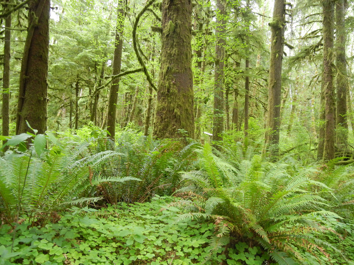
Plant on Plant: The atmosphere of the rain forest is so fertile that some plants thrive on air alone.  Dining on moisture and nutrients from rain and wind-borne particles, they fasten to trunks and branches but do not harm their hosts.


DSCN2611

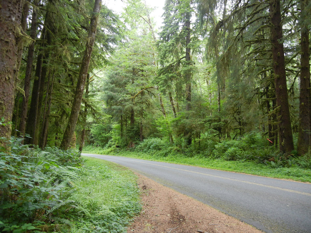
In the Hoh Rain Forest, every inch of earth is covered except the road leading into the park.

Read more »

Categories: Olympic Peninsula, Washington | Comments Off on Forks, Washington…

Lake Crescent, Washington…

lakeJUNE 20, 2014. This morning we drove to Lake Crescent, located about 20 miles west of  Port Angeles. It’s a cold, clear, glacially-carved lake, more than 600 feet deep. The water in the lake contains very little nitrogen, which limits the growth of plankton usually found in lake water. As a result, the water here is unusually clear and it has an beautiful blue-green color. There are two types of trout found here and in no other place in the world. I didn’t catch one of either. I didn’t try, but if I had I’d still probably not have bagged one. My best fishing days are at trout farms. Ha!

Read more »

Categories: Olympic Peninsula, Washington | Comments Off on Lake Crescent, Washington…

Port Townsend, Washington…

olympicpen

On this map, it’s easy to trace our counter-clockwise trip around the Olympic Peninsula. We went north up the peninsula along the Hood Canal and we’ll continue on 101 all the way around the circle back to the Olympia area.

JUNE 19, 2014. Today we drove to Port Townsend, about 20 miles from our campsite in Sequim. In addition to its natural scenery at the northeast tip of the Olympic Peninsula, the city is also known for the many Victorian buildings remaining from its late 19th-century heyday, numerous cultural events and as a maritime center for independent boat-builders and related industries and crafts. Since the 1970s new residents, including many retirees, have moved to town. The waterfront retail district has restaurants, services and tourist destinations. Since 1999, the city has had an annual international film festival in September. Other cultural programming, some at Fort Worden, now a state park, includes a Wooden Boat Festival, writers’ conference, and blues and jazz festivals, in addition to music and dance performances. The town has an independent movie theater, upgraded in 2012 to handle digital film.

Read more »

Categories: Olympic Peninsula, Washington | Comments Off on Port Townsend, Washington…

Sequim, Washington…

lighthouse

Dungeness Lighthouse in Sequim, Washington.

JUNE 17, 2014. We’ve arrived in the town of Sequim, (pronounced “Sqwim”) about 70 miles up the coast from our stay in Hoodsville and right at the top of the Olympic Peninsula. The drive this morning up Scenic Route US 101 along the Hood Canal was beautiful, but a bit scary as the road is narrow, the bridges are even narrower and the 18 wheeler logging trucks zoom around like there’s no tomorrow! We’ll be in this area about five days, before we drive west to Forks and then continue counter-clockwise down Highway 101. Then we’re going to venture back into Oregon to Eugene and Redmond before we begin our trek across the country to the East Coast in time to see the Fall colors.

Read more »

Categories: Olympic Peninsula, Washington | Comments Off on Sequim, Washington…

Hoodsport, Washington…

photo (2)

Our campsite in Hoodsport, Washington. It doesn’t get much better than this…and there’s not another soul around!

JUNE 14, 2014.

DOW CREEK RV RESORT. Washington is a state with a widely varied landscape. We left behind us this morning the sound of the surf, yet after a drive of only a few hours we’re in an entirely different geographic area: heavily wooded forest right by the Hood Canal and Lake Cushman. Hoodsport, Washington. Population: About a handful. The canal is a fjord forming the western lobe, and one of the four main basins, of Puget Sound. It is not a canal in the sense of being a man-made waterway…it is a natural waterway. Our home for the next few days is the Dow Creek RV Resort…one of the very nicest spots we’ve occupied since our Journey began. The name is deceptive: “resort” sounds sort of “country-clubish.” To the contrary, we’re surrounded by tall pines in an undisturbed forest. Lush ferns and a carpet of pine needles cushion the forest floor. No sound of footsteps here! Not another vehicle or a building in sight. I’m guessing there are bears around here. Why wouldn’t there be?

Read more »

Categories: Olympic Peninsula, Washington | Comments Off on Hoodsport, Washington…

A rainy day at the beach…

IMG_2200

As you can see from my weather radar screen, we’re getting some rain.  It’s not too heavy but it’s enough to keep us inside today. That’s fine…lots to do.

JUNE 12, 2014

QUINAULT CAMPGROUND, OCEAN SHORES, WASHINGTON. We’re still camped by the dunes and the beach at Ocean Shores. Today is a rainy day…it’s a good day to relax, play board games and read a book. If you’ve looked at my “Recent Reads” page lately, you’ll see that I’m chugging right along. I’ve read more books of interest in the last year than ever before, I think. One of the things I like to do on this kind of a day is cook. I had a fresh turkey breast in the refrigerator so I decided today would be the perfect day to prepare it. I’ve already cooked big “holiday meals” several times in the RV during the year that we’ve been traveling and it works out pretty well, considering the space limitations. So on this evening’s menu will be: Fresh roast turkey, pan gravy, cranberry relish, fresh green beans and cornbread stuffing with nuts and raisins. No relish tray, no creamed onions and no berry pie for dessert, but hey: not bad for a tiny mini-kitchen and a pretty small refrigerator.

Read more »

Categories: Animals, Olympic Peninsula, RV Cooking, Washington | Comments Off on A rainy day at the beach…

Seabrook, Washington…

DSCN2437

The Town Hall is the large white building with a spire. The retail shops, stores and restaurants are in a close-by but separate part of town.

JUNE 10, 2014. 

SEABROOK, WASHINGTON. We took a drive this afternoon and discovered several little beach-cottage-communities just north of our campsite at Ocean Shores. One of the most interesting is called Seabrook. It’s a planned community…literally brand new. It’s primarily rentals and vacation property., described in the sales literature as follows:

The developer: “Seabrook is a dream that began years ago during childhood beach vacations in the Pacific Northwest. Inspired by those memories, and firmly rooted in the architectural traditions of a bygone era, the developers are creating an authentic beach village to nestle within the spectacular natural beauty of the Olympic Peninsula. It will itself grow even more beautiful with time.”

Read more »

Categories: Olympic Peninsula, Washington | Comments Off on Seabrook, Washington…

Ocean Shores, Washington…

oceanshores7

Shops on the boardwalk at Ocean Shores. 

JUNE 9, 2014

Meandering up the coast en route to the northernmost tip of Washington State, we stopped today at Ocean Shores, a little town in Grays Harbor County. We hadn’t planned to stay here, but it appears too good to be true, so we’ll stay a few days before continuing. We’re boondocking right on the beach, adjacent to the Quinault Beach Resort and Casino, named for the Quinault Indians who’ve lived on this land for hundreds of years. That’s right, folks… we’ve got an uninterrupted ocean view, no neighbors, no formal campground, no buildings, no rules and no charge! What a deal. We’ve learned from experience so far that we can comfortably camp for up to a week without any utilities, so we’re set!

Read more »

Categories: Olympic Peninsula, Washington | Comments Off on Ocean Shores, Washington…

Olympia, Washington…

DSCN2387

The state capital building in Olympia. I took this picture from Heritage Park, located on Puget Sound.

JUNE 8, 2014

It’s Sunday and we’re spending the night in Olympia, before we head up Scenic Highway 101 to the Ho Rainforest and the peninsula. Olympia is the capital of Washington state and it’s located at the southern end of Puget Sound. We spent the afternoon visiting some of the many parks in the area and exploring the waterfront on the Sound. There are so many little inlets and coves that waterfront residential property is plentiful…expensive I’m sure, but plentiful. Each cove seems to have its own name: Boston Harbor, Gull Harbor…it’s as if the neighbors in each area sat around and dreamed up a name for their tiny “neighborhood.” There are also lots of marinas brimming with nice yachts for sailing around these beautiful bays and coves. There are some absolutely charming little homes overlooking the water. Some huge ones, too. They’re tempting, but it’s easy to forget on a beautiful summer day with the sun shining how cold and wet the weather is here during much of the winter.

Read more »

Categories: Olympic Peninsula, Washington | Comments Off on Olympia, Washington…

We’re getting there…

IMG_2181

Our US travel map sticker…it’s posted outside on the slide-out by the patio awning area. “We’re getting there.”

JUNE 4, 2014

We’ve been traveling and living in our motor-home on a full time basis for almost a year and we’re “getting there” on our Journey across America. I’ve driven about 6,000 miles. We’ve learned lots about our rig and lots about ourselves as we’ve grown accustomed to true retirement and its guiding principle: “What’s the rush?” It’s good we’ve come to grips with the reality that we’ve got all the time in the world and that we needn’t hurry, since we’ve found that our Journey is unfolding slowly and that it’s going to take much longer than we suspected to see the country and all that it holds for us. What we don’t want to do is mimic the “city bus tour” approach to travel, which allows for not much more than briefly laying eyes on the places we visit. We’re trying to balance our desire to get a close look at American while keeping in mind that there’s a lot of ground to cover and there remain many, many places we still want to explore.

Read more »

Categories: Olympic Peninsula, Washington | Comments Off on We’re getting there…

Mt. Rainier, Washington…

spaceneedle

The Space Needle in Seattle, Washington with Mt. Rainier in the background.

JUNE 1, 2014

Our stay in Washington with John and Jude is about to end. We decided to take a day trip to Mr. Rainier. I’ve been wanting to go there for years. Ever since I took Steph to the University of Puget Sound many years ago for her first year at college and saw snow-capped Mt. Rainier in the distance, it’s been on my list of  ‘wanna visit places. Today’s the day! The sun is shining. Perfect. It’s about a two hour drive, so let’s get going!

Read more »

Categories: History, National Parks, Washington | Comments Off on Mt. Rainier, Washington…

Mt. St. Helens, Washington…

helens

This photograph was taken as Mt. St. Helens erupted in what was the most destructive volcanic activity ever to occur in the United States. May, 1980.

MAY 30, 2014

Today dawned warm and sunny…a perfect day for a trip to Mt. St. Helens to witness the beauty of the snow capped mountain and see the devastation still remaining from the volcanic eruption which occurred there in May of 1980. Mt. St. Helens is an active volcano located in Washington state about 50 miles northeast of Portland, Oregon. The volcano is located in the Cascade Range. It is well known for its ash explosions and pyroclastic flows.

Read more »

Categories: History, Mt. St. Helens, National Parks, Washington | Comments Off on Mt. St. Helens, Washington…

Toutle, Washington…

Our "campsite" at John and Jude's beautiful home in Washington.

Our “campsite” at John and Jude’s beautiful home in Washington.

MAY 27, 2014

We’re spending about a week with my brother-in-law and his wife in the little community of Toutle, Washington. It’s located about 10 miles east of Interstate 5 and only 70 miles north of Portland, Oregon. They live in the Silverlake Forest Reserve and their 7 acre property is jaw-droppingly beautiful! The home they built here a few years ago is literally surrounded by forest land…impressive mature pine trees…and it has a “view across forever” to the Mt. St. Helens area, which is the major attraction in the area.

Read more »

Categories: Washington | Comments Off on Toutle, Washington…

Keeping our motor-home clean on the road…

IMG_1486

Alex always kept our motor-home looking like new!

AT HOME, ALEX ALWAYS KEPT OUR MOTOR-HOME SPOTLESS. I like to keep it clean as a whistle. Before embarking on Our Great American Adventure, Alex was the answer. (He was our “ranch hand.” He and his wife and baby girl live in Tecate, Mexaco, but he lived with us during the week while he worked for/with us at home.) He ‘d wash the RV and hand wax it to perfection. I’m not sure how he did such a good job so quickly, but over the years I came to realize that in addition to being a great guy and one of my best friends, he was a heck of a good worker! It’s rare to find someone with such a work ethic. He’d work all day, clean up, have dinner with us and then ask what else he could do inside the house before bedtime. All the while, I’d be helping him with his English…teaching him phrases, idioms and words new to him. I really enjoyed our time together and I’m sure he did as well. And boy did his English improve!

Read more »

Categories: Misc | Comments Off on Keeping our motor-home clean on the road…

Wilsonville, Oregon…


DCF 1.0

A condominium neighborhood in Wilsonville.

MAY 20, 2014. Wilsonville is a suburb of Portland, about 20 miles south on Highway 5. We liked it so much when we stayed at Pheasant Ridge RV park that I decided to post some information here. After all, our Great American Adventure won’t last forever and we’re going to need to settle down somewhere, right? In many ways, there just couldn’t be a much nicer place to retire than right here. Actually, we like the entire area along Interstate 5 from Salem all the way north to Portland. Although the  coastline is beautiful and dramatic, it has just too much rain for us to be interested in living there. Not a problem, because it’s only about an hour’s drive to the coast from most of these Salem-Portland neighborhoods we like so much. (A lady we met in Astoria a few years ago told us that the annual rainfall in that city often exceeds 110 inches annually. That’s just too wet…no matter how beautiful it is in the summertime!)

Wilsonville is located primarily in Clackamas County, but a little portion of the northern section is in Washington County. It was originally founded as Boones Landing, due to the Boones Ferry, which crossed the Willamette River at the location. It was re-named Wilsonville in 1880. Today’s population is about 24,000. Located within the Portland metropolitan area, the city also includes the planned community of Charbonneau on the south side of the river. The city is bisected by Interstate 5, and includes I-5’s Boone Bridge over the Willamette River.

wilson1

The annual rainfall here is only about 40 inches. And as you can see from the graph, the temperature is pretty moderate all year long.

wilson5

It’s green and beautiful everywhere. This is a little city park…they’re everywhere.

Wilsonville has a council-manager form of government and operates its own library, public works, and parks department. Fire and police protection are contracted out to other regional government agencies. The city is home to several technology companies including Mentor Graphics, along with Stream Global Services. Xerox as a large facility as well. Wilsonville contains many distribution and manufacturing buildings adjacent to Interstate 5 such as regional distribution facilities for Coca Cola and Rite-Aid. Retail centers include Argyle Square on the north and the Town Center Shopping Center to the south. Media in Wilsonville consists of the Portland area broadcast stations, regional newspapers, and the local Wilsonville Spokesman newspaper.

wilson10

 river

wilson8

City park in Wilsonville.

Categories: Oregon | Comments Off on Wilsonville, Oregon…

Columbia River Highway… Scenic Byway Route 30…

route30MAY 16, 2014

AN AFTERNOON SPENT DRIVING THE BYWAY.  The drive along this road, which is the old route along the Columbia Gorge now “replaced” by Highway 84, is absolutely spectacular. Any way you look at it, this Historic Columbia River Highway Scenic Byway is a marvel—for its visionary engineering, incredible scenery, and rich history. Internationally lauded for spectacular waterfalls, architectural gems, and magnificent overlooks of the Columbia River Gorge, it’s no wonder this Byway has been called the “King of Roads.”

orchards

We drove past some beautiful orchards on the drive to Troutdale and east along the Columbia Gorge on Old Highway 30. Mt. Hood in the background.

From Portland, we drove East on Highway 84 to exit 17 and followed the signs through the quaint town of Troutdale and over the Sandy River to the Byway. The road follows the Sandy for several miles and then climbs past orchards and blueberry fields through the little communities of Springdale and Corbett. Snow-capped Mount Hood is clearly visible from the road. The road is narrow and winding…driving speed is limited to about 10 miles per hour in many areas. The road’s steep vertical drop from Corbett down to the river is accomplished with a series of figure eight loops that gracefully wind down the mountain. Once there, we were immediately surrounded by mossy tree limbs overhanging the road. We encountered a series of remarkable waterfalls along our route. Horsetail Falls plummets close enough to the road that it misted our windshield! It was a great drive on a nice sunny day. That’s good, because rain is on the way for the weekend.gorge

Categories: History, National Parks, Oregon, Scenic Byways | Comments Off on Columbia River Highway… Scenic Byway Route 30…